Educational Tools and Programs
The following is a list of educational programs, tools, and websites that H-GAC coordinates and maintains to raise awareness about current water quality challenges facing the region.
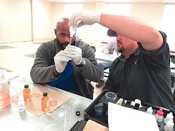
Texas Stream Team is a state-wide network of trained volunteers and partners who collect water quality information. Texas Stream Team is administered through a cooperative partnership between Texas State University, Texas Commission on Environmental Quality (TCEQ), and the U.S. Environmental Protection Agency (EPA).H-GAC provides regional Texas Stream Team training for volunteers who collect quality-assured data that can be used to make environmentally sound decisions. Volunteers complete three phases of training that includes classroom instruction, practice implementing monitoring procedures, and one-on-one training in the field using a test kit that measures physical and chemical parameters in water. H-GAC’s Texas Stream Team program has 133 volunteers collecting samples at 123 sites in 33 watersheds.
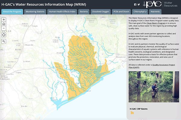
The Water Resources Information Map (WRIM) is an interactive mapping tool designed to display H-GAC’s CRP water quality data from more than 450 monitoring locations. Featuring a mobile-friendly design, this tool is available to anyone from water quality project managers to residents interested in current and historic water quality data in the region.
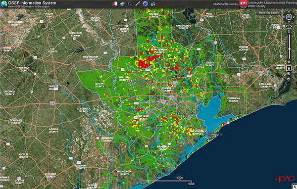
There are over 92,000 on-site sewage facilities (OSSFs) in the region, many of which are failing and outdated. To understand the magnitude and scope of OSSF contributions to waterways impaired for elevated bacteria, H-GAC identified the locations for all permitted systems within region and provides this information as a database resource to permitting authorities or authorized agents. The OSSF Information System is a GIS-based online mapping tool that displays collected OSSF data used by OSSF professionals and is available to the public. The application allows users to locate, select, and review specific permits, and create workday driving routes to streamline day-to-day operations.
H-GAC maintains a website that provides public access to all CRP project and program data, as well as links to various mapping tools and watershed planning efforts. The website also provides access to all reports and studies that H-GAC has produced under the Clean Rivers Program.
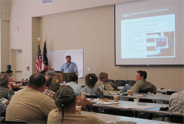
In 2011, H-GAC CRP staff began offering Real Estate Inspection Training for OSSFs. In 2013, continuing education credits were given for the course through the Texas Real Estate Commission (TREC). The focus of this course is to instruct real estate inspectors on how to visually inspect an OSSF during a point-of-sale inspection and to educate clients on how to maintain an OSSF. TREC approved this course for six continuing education units. Courses were offered for areas of concern, derived from mapping the unpermitted and potentially-grandfathered OSSFs. A total of approximately 150 to 160 attendees have participated with more courses expected in the coming years. Learn more on the Water Quality Management Planning page on H-GAC’s website.
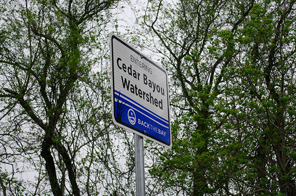
H-GAC installed watershed signage for many local waterways, including the San Bernard River, Bastrop Bayou, and Cedar Bayou. The signage educates residents about their potential impact on the waterways and raises general awareness of the relationship between the public and water quality.
In collaboration with TCEQ, H-GAC developed a Coastal Communities program to provide resources and services to small coastal communities. The goal of the program is to help small coastal communities by identifying funding resources, providing basic planning services related to pollution reduction, and facilitating coordination among local partners.
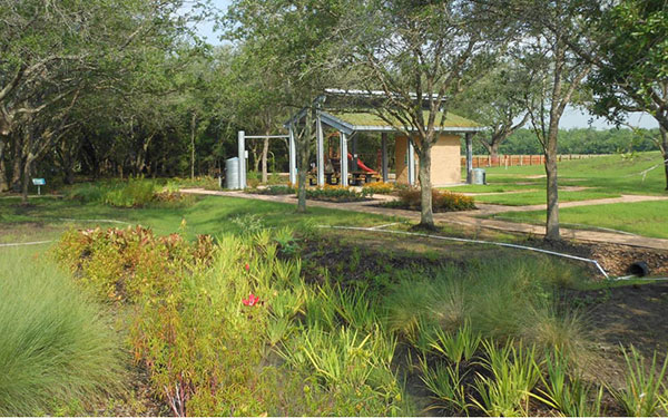
With funds from the EPA Gulf of Mexico Program, H-GAC developed a Designing for Impact project to promote the use of low impact development (LID) in the region through a three-pronged approach: launching a webpage, publishing a LID guide, and hosting LID workshops.
The LID webpage provides an overview of LID, resource documents, and a LID photo gallery. The webpage includes an interactive mapping tool with 60 regional development projects incorporating LID and details about each project.
The Designing for Impact: Regional Guide to LID is an educational tool describing what LID is, its benefits, and how it functions. It includes a detailed list of common LID best management practices and a cost-benefit analysis comparing five hypothetical LID site plans and conventional site plans. The guide also highlights five local development case studies.